
Topic
society
16 record(s)
Type of resources
Available actions
Provided by
Formats
Representation types
Update frequencies
Status
Scale
-
The layer provides quantitative information about the inhabitants main points in the different countries for the ECOWAS region
-
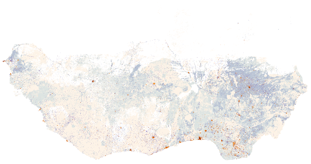
The dataset is the output of a model for the rural and urban population distribution on the field, at 1km resolution, and entirely based on public and freely available datasets (WorldPop, Global Land cover 30m, GPWv4, OpenStreet map and the Gazetteer Geonames). Basically the model subdivides the population in two main categories: 1) People living in agglomerations (from cities to smallest villages) 2) The so called sparse population which is the remaining population living in small villages or isolated placements that cannot be captured by remote sensing or that are not listed in the common gazetteers. The identification of the agglomeration was done principally by using the artificial surface class from Global Land Cover (GLC 30m resolution) together with Gazetteer punctual data. People allocation is done by using rules for densities and different thresholds based on national values. The sparse population was estimated using relative weights associated with land use classes.
-

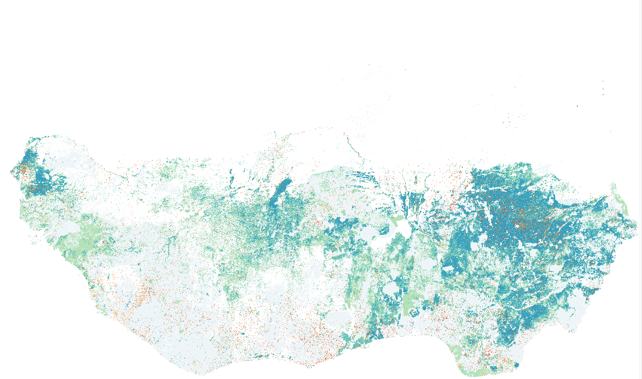
Dataset includes an estimation of the demand for electricity from households onto a geographic grid at 1km x 1km of spatial resolution. Dataset mainly focus on the demand for electricity of urban residential, commercial, and small industries, according to the WAPP 2013 (Miketa, A. and Merven, B., 2013) subdivision. Dataset does not include demand from heavy industry (e.g. mining), which connects to generation at a high voltage and generally requires less transmission and no distribution infrastructure. Taking that into consideration, in rural areas the electricity demand can be considered closely related to the number of inhabitants, the principal dis-aggregation algorithm, that estimates the electricity demand for each cell (x,y) of the geographic grid is based on:. Electricity demand(x,y) = electricity demand(capita) * number people(x,y) where Electricity demand(x,y) corresponds to the demand for the cell at the x,y position, the electricity demand per capita is calculated at national level according to IRENA 2013 data, and the number of people (x,y) corresponds to the people living in the cell at the x,y position Data is expressed as electricity demand in MWh per year per cell for the year 2015
-
This dataset includes an estimation of the demand for electricity from households onto a geographic grid at 1km x 1km of spatial resolution. Dataset mainly focus on the demand for electricity of rural residential and commercial, according to the WAPP 2013 (Miketa, A. and Merven, B., 2013) subdivision. Taking that into consideration, in rural areas the electricity demand can be considered closely related to the number of inhabitants. The principal dis-aggregation algorithm, that estimates the electricity demand for each cell (x,y) of the geographic grid is based on: Electricity demand (x,y) = electricity demand (capita) * number people (x,y) where Electricity demand (x,y) corresponds to the demand for the cell at the x,y position, the electricity demand per capita at national level, is assumed equal to 250 kWh per year per household according to IEA data ( IEA 2011: Energy4ALL), and the number of people (x,y) corresponds to the people living in the cell at the x,y position. IEA defines modern energy access as " a household having reliable and affordable access to clean cooking facilities, a first connection to electricity and then an increasing level of electricity consumption over time to reach the regional average" Data is expressed as electricity demand in KWh per year per cell for the year 2015
-
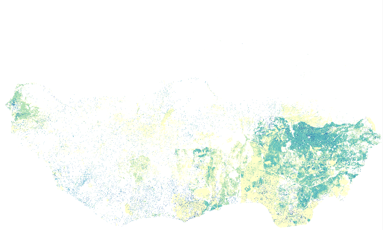
This dataset includes an estimation of the demand for electricity from households onto a geographic grid at 1km x 1km of spatial resolution. Dataset mainly focus on the demand for electricity of rural residential and commercial, according to the WAPP 2013 (Miketa, A. and Merven, B., 2013) subdivision. Assuming that, in rural areas the electricity demand can be considered closely related to the number of inhabitants. The principal dis-aggregation algorithm, that estimates the electricity demand for each cell (x,y) of the geographic grid is based on: Electricity demand(x,y) = electricity demand(capita) * number people(x,y) where Electricity demand(x,y) corresponds to the demand for the cell at the x,y position, the electricity demand per capita is calculated at national level according to IRENA 2013 data, and the number of people (x,y) corresponds to the people living in the cell at the x,y position. Data are expressed as electricity demand in KWh per year per cell for the year 2015
-
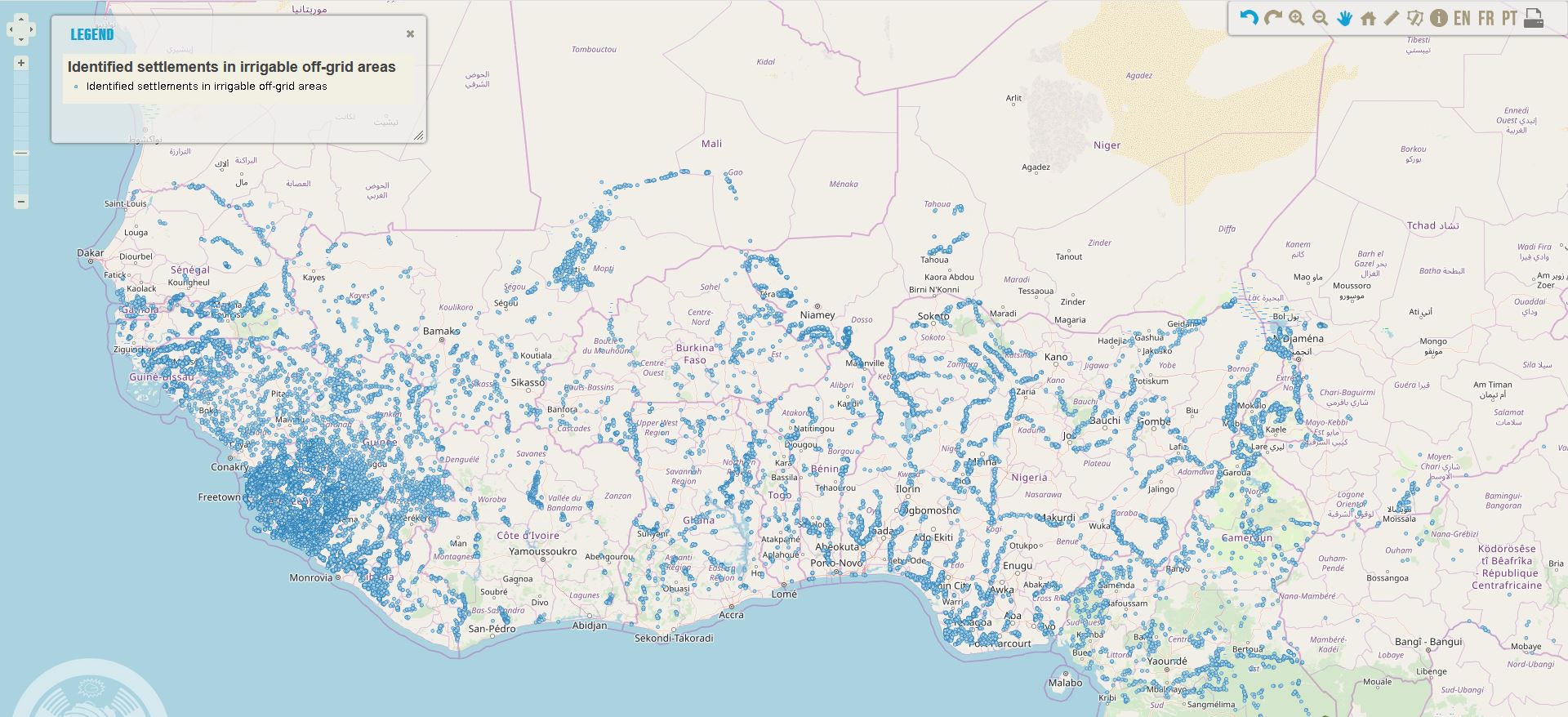
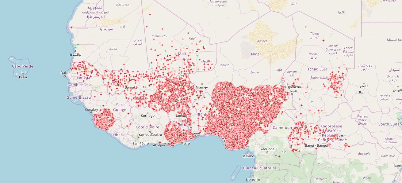
Location of settlements in West Africa in identified irrigable off-grid areas in 2018, that could still be in off-grid areas in 2023 according to the least-cost analysis conducted in the framework of the off-grid solar market assessment and private sector support facility design, which was done as an activity of the sub-component 1A of the Regional Off-Grid Electrification Project (ROGEP).
-

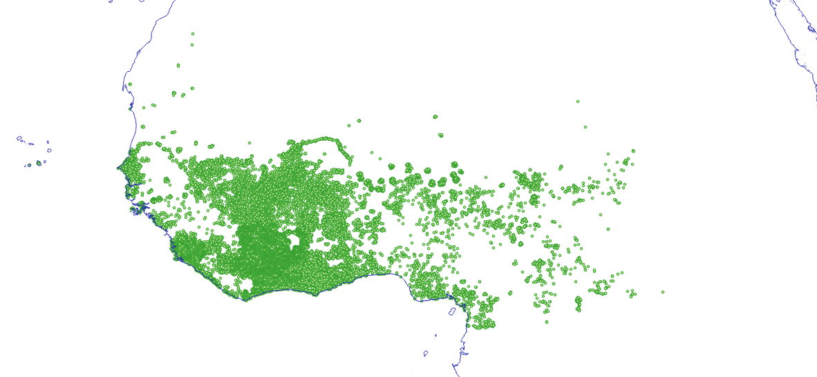
Location of settlements that could have access to electricity through off-grid solutions by 2030 according to the least-cost analysis conducted in the framework of the off-grid solar market assessment and private sector support facility design, which was done as an activity of the sub-component 1A of the Regional Off-Grid Electrification Project (ROGEP).
-
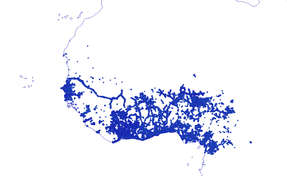
Location of settlements that could be connected to national electricity grids in 2023 according to the least-cost analysis conducted in the framework of the off-grid solar market assessment and private sector support facility design, which was done as an activity of the sub-component 1A of the Regional Off-Grid Electrification Project (ROGEP).
-
Location of health facilities that could have access to electricity through off-grid solutions by 2023 according to the least-cost analysis conducted in the framework of the off-grid solar market assessment and private sector support facility design, which was done as an activity of the sub-component 1A of the Regional Off-Grid Electrification Project (ROGEP).
-
Location of settlements that could have access to electricity through mini-grids in 2023 according to the least-cost analysis conducted in the framework of the off-grid solar market assessment and private sector support facility design, which was done as an activity of the sub-component 1A of the Regional Off-Grid Electrification Project (ROGEP).