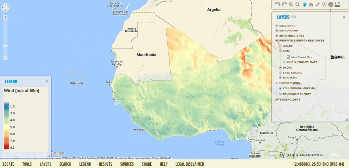
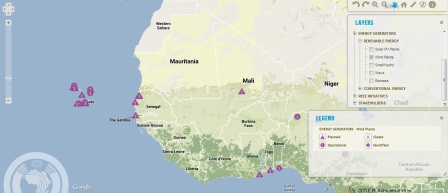
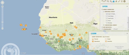
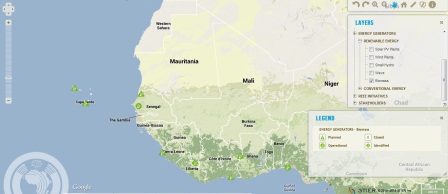
MAP Viewer
|
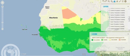
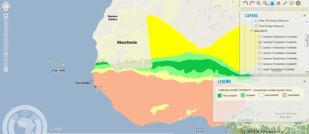
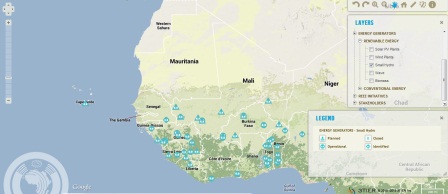
It provides more than 100 geospatial layers related to energy resources and other information relevant for energy planning. Users can query and search by well structured attributes, overlay and analyze these resources together, download and share the data. You can also find the interaction among key energy stakeholders and locations of operational and planned power plants. |
|
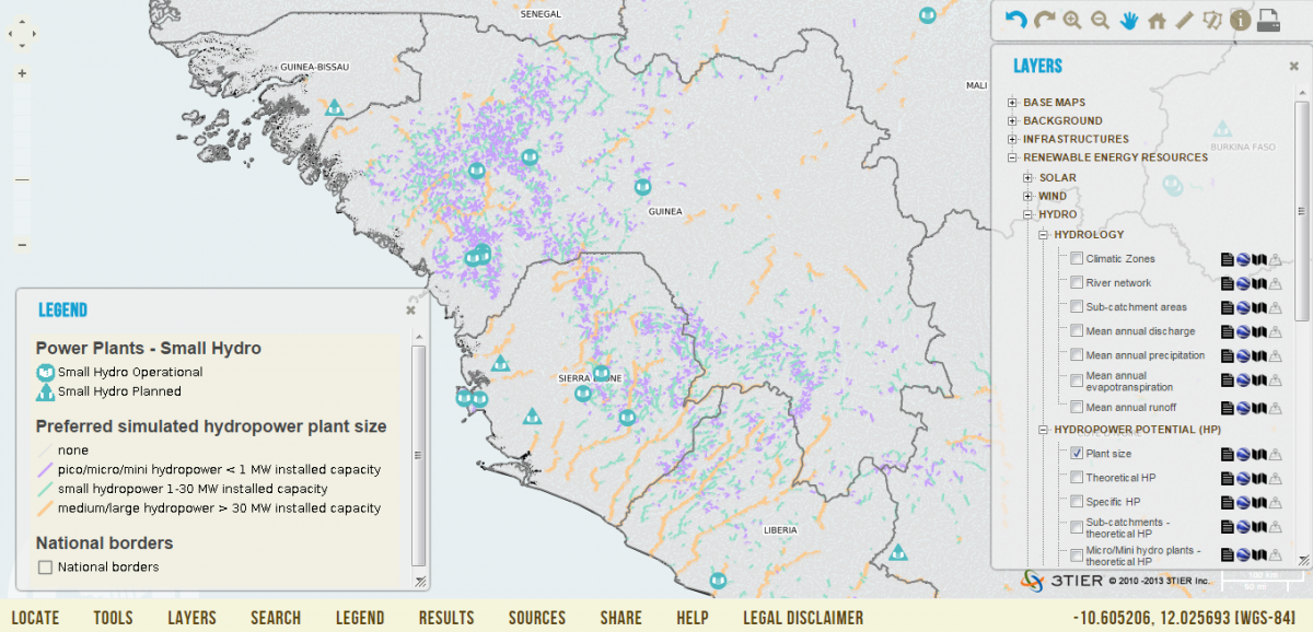
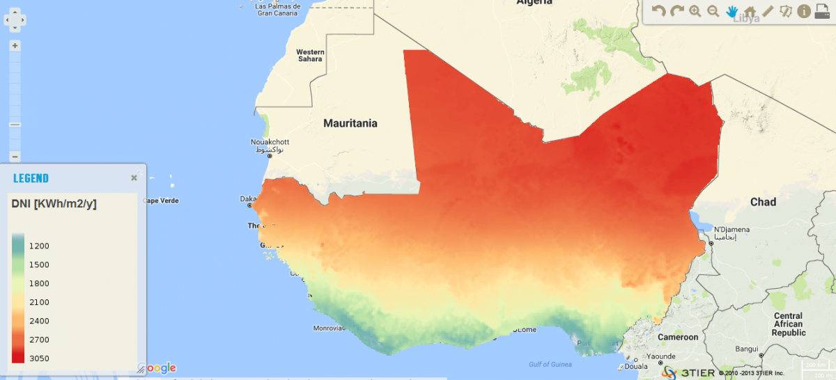
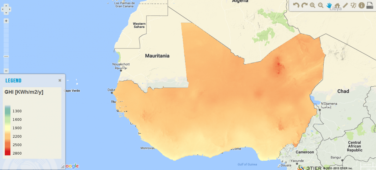
Click the map image below to explore the Observatory GIS Viewer
|
After the implementation of the ACP-EU Project ECOWREX 2, the map viewer:
- Is totally OGC standards compliant;
- Is easily linked to other initiatives or projects;
- Some new functionalities have been added to increase the user's interaction with the geospatial content.
Map Footer
SERVICES
Web Map Service (WMS)
To provide access to visualise geographic information. It uses the original spatial data to dynamically produce and supply maps in the form of an image archive (PNG, GIF, JPEG, etc.). It provides an image for a required area which comes from a GIS data file contained in the ECOWREX SDI. It is organised into one or more layers that can be viewed or hidden one by one. Certain available information can be consulted and the map image characteristics. The standard defines three operations:
- -Returning metadata from the service (GetCapabilities operation). Obligatory.
- -Returning a map from some geographic and dimensional parameters defined (GetMap operation). Obligatory.
- -Returning information on particular characteristics shown on the map (GetFeatureInfo operation). Optional.
ECOWREX offers acces to WMS through URL: http://www.ecowrex.org/geoserver/ecreee/wms
Web Feature Service (WFS)
The WFS standard defines the framework for providing access to, and supporting transactions on, discrete geographic features (a transmission line, a power plant, a climatic zone, etc.) in a manner that is independent of the underlying data source. Users have access to the source spatial and attribute data in a manner that allows them to interrogate, style, edit (create, update, and delete), and download individual features. The transactional capabilities of WFS also support the development and deployment of collaborative mapping applications. A WFS encodes and transfers information in Geography Markup Language (GML), a subset of XML.
ECOWREX offers acces to WFS through URL: http://www.ecowrex.org/geoserver/ecreee/wfs
Web Coverage Service (WCS)
According to its specification this OGC service allows the obtention of geospatial data in a coverage format that represent phenomena with space and time variation (solar irradiation, wind speed, land cover, etc.). In this way it is useful for digital representation of this type of geographical information as input data in scientific models or for other type of clients.
ECOWREX offers acces to WFS through URL: http://www.ecowrex.org/geoserver/ecreee/wcs
ECOWREX METADATA CATALOGUE
A Catalogue Service permits the publication and search for information (metadata) that describes data, services, applications and in general all types of resources. The catalogue services are necessary to provide search skills and invocation over the resources registered within an SDI. It is the keystone to be able to locate, administer and maintain distributed geo-sources (spatial data, applications and services).
The ECOWREX metadata catalog links each layer on the map viewer to its corresponding metadata record. It stores data documentation and make it searchable. Through the metadata catalog other projects and initiatives will be able to directly harvest the ECOWREX metadata and push them into a global visibility.
ECOWREX offers acces to the Metadata catalogue through URL: http://www.ecowrex.org:8080/geonetwork
Specifications:
- Based on standard ISO 19115/19139;
- CSW service: Catalog Service for the Web based on the OGC standard;
- Can be harvested by other metadata catalogs through the OGC Catalogue Service for the web (CSW);
- Developed with GeoNetwork.
Click here or the image below for more information on metadata catalogs. Click here to explore an example of a GeoNetwork catalog.
![]()
GLOBAL GEOSPATIAL COMMUNITIES AND INITIATIVES
|
|
|
|
|
|
|
|
 |